Basic Info
Basic Information
|
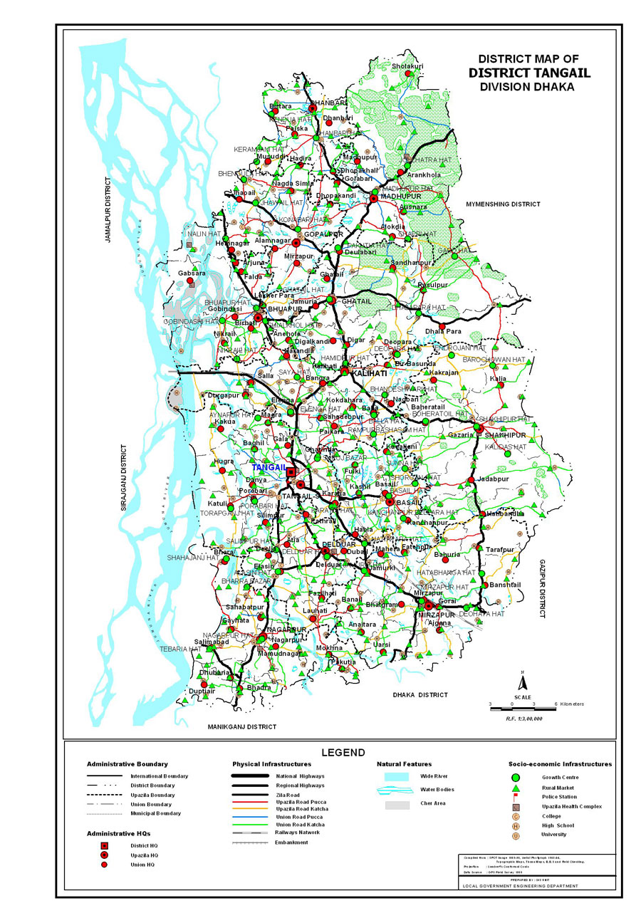
| Tangail District (Dhaka division) with an area of 3,424.39 sq km, is bounded by jamalpur district on the north, dhaka and manikganj districts on the south, mymensingh and gazipur districts on the east, sirajganj district on the west. Main rivers: jamuna, dhaleshwari, Jhenai, Bangshi, Lohajang, Turag. Madhupur forestry and Sukhipur and Ghatail hillocks are notable. Average annual temperature: maximum 33.3 oC, minimum 12 oC; annual rainfall 1467 mm. |
At a Glance
|
| Area: |
3,424.39 Km2 |
| Upazila Road: |
909.81 Km |
| Union Road: |
1107.38 Km |
| Village Road: |
2819.76 Km VA |
| 2140.18 Km VB |
| Population: |
35,08,556 |
| Density: |
975 per Km2 |
| Literacy: |
40.50 % |
| Upazilas: |
12 |
| Union: |
107 |
| Pourashavas: |
8 |
| Primary Schools: |
937 |
| High Schools: |
428 |
| Colleges: |
82 |