Background: Originally Faridpur was named Fatehabad. Subsequently, it was renamed as Faridpur after the name of a renowned saint named Shah Farid who settled here at the early thirteenth century. He was buried in the present place of Faridpur town after his death.
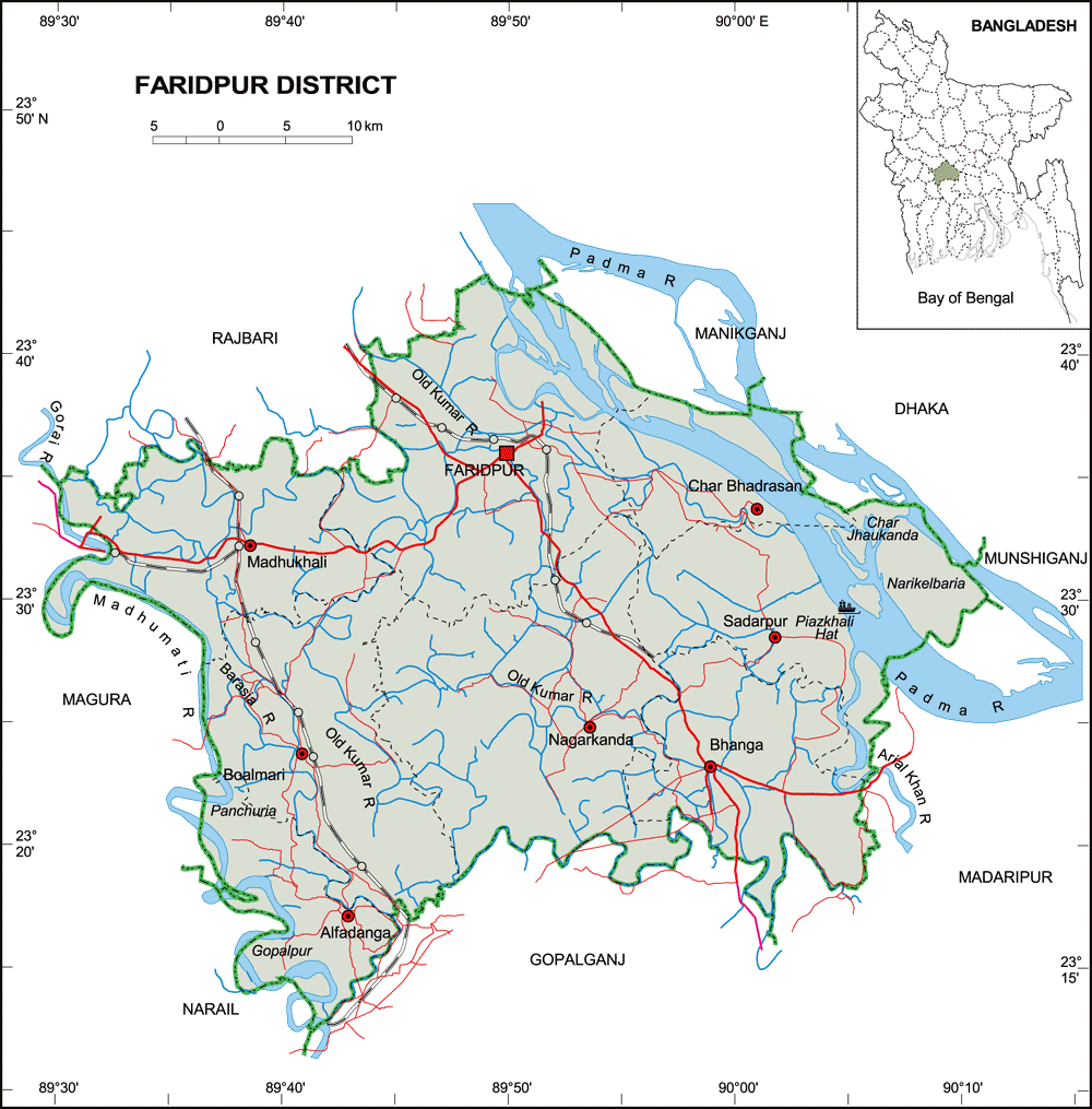
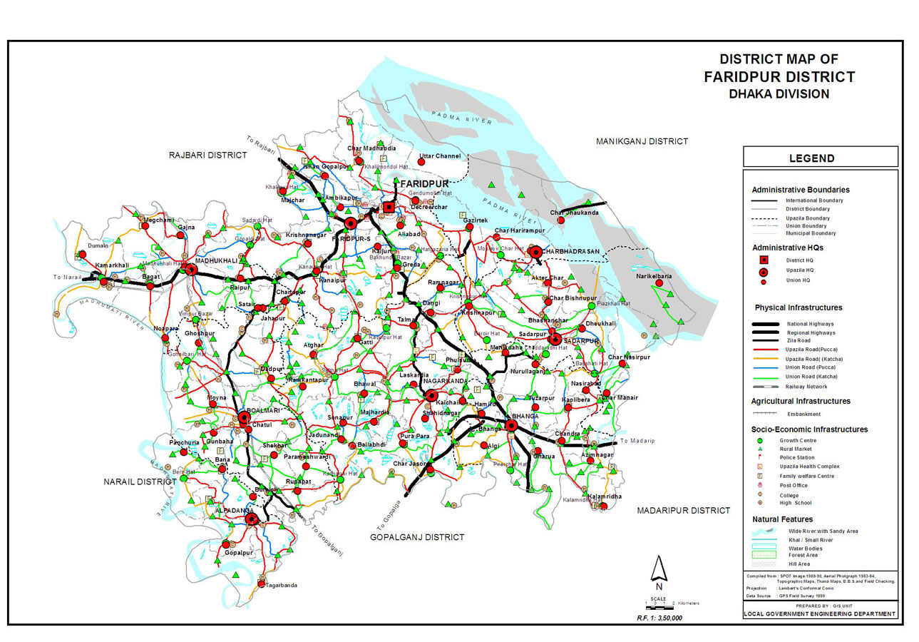
Geographic Area and Location: Faridpur is bounded on the north by Manikganj, Dhaka and Rajbari districts, on the east by Madaripur, Dhaka and Munshiganj districts, on the south by Gopalganj and Madaripur districts and on the west by Rajbari, Magura, and Narail districts. At the border area of Faridpur there are two big rivers one is Padma and another is Meghna .Padma separated Faridpur from Pabna & Dhaka districts at its north- east part and merged with Jamuna at Goalanda upazilla of Rajbari district. It lies between 23°17’ and 23°40’ north latitude and between 89°29’ and 90°11’east longitudes. The total area of the district is 2052.86 sq. km (792.00 sq.miles).
Historical & Tourist Place: Gerda mosque (1013 AH), Pathrail mosque and dighee (1493-1519 AD), Satoir mosque (1519 AD), District judge court building(1889 AD), Bhanga munsif court building (1889) are some historical places. Palli Kabi Jasim Uddin’s house & graveyard are located at Faridpur District. River research institute, Hazrat Shah Farid mazar, Gour Gopal Angina, Jagabandhu angina, Atrashi and Chandrapara Pak Darbar Sharif, Baish roshi Jamidar bari(Sadarpur),Satair Masjid(Boalmari),Mothurapur deul(Modhukhali), Pathrail mosjid (Bhanga) are some visiting places of this district.
Annual Average Temperature and Rainfall: Annual average temperature varies from maximum 35.8c to minimum 12.6c and annual rainfall is 1546 mm.
Administrasion: Faridpur district was established in 1815. Faridpur municipality was established in 1869. The district consists of 9 upazila, 81 unions, 1038 mauzas and 1899 villages.It also comprised of 4 paurashavas, 36 paura words and 100 mahallas. The upazilas are Alfadanga, Bhanga, Boalmari, Charbhadrasan, Faridpur Sadar, Madhukhali, Nagarkanda, Sadarpur and Saltha.
Renowned Personality: Ambika Charan Majumdar, great Politician & Social worker, Hazi Shariat Ullah, Palli Kabi Jasim Uddin, Bir Shesto Lans Nayek Munsi Abdur Rauf, Iusuf Ali Chowdhury, Politician and Humayun Kabir, Educationalist are from this district.
Constituency: There are 4 constituencies in Faridpur district. Constituency-1 consists of Alfadanga, Boalmari, Madhukhali upazilas.Constituency-2 consists of Nagarkanda, Shaltha upazilas. Constituency-3 consists of Faridpur sadar and Constituency-4 consists of Bhanga, Sadarpur and Charbhadrason upazilas.
Population: Total population of Faridpur district is 19,12,969, of them 9,42,245 is male and female is 9,70,724.
Literacy & Educational Institution: Literacy rate of Faridpur district for both sexes is 49.0%, of them male is 50.3% and female is 47.7%. Number of government collages are 8, non-government collages are 24, government high schools are 6, 189 non- government highs school 254, government primary schools are 543 and registered primary school and registered primary school are 277.
Main crops: Paddy, jute, wheat, oilseed, pulse, onion, garlic and sugarcane are main crops of this district.
Industry: Faridpur sugar mill, Karim jute mills, Bs jute mill, Aziz pipes, Nur plastic pipe are some famous industries of Faridpur district.
Economic Situation: The economy of Faridpur is predominantly agricultural. Out of a total of 382,686 holdings of the district, 57.97% holdings are farms that produce varieties of crops namely local and HYV paddy, sugarcane, wheat, vegetables, spices, jute, pulses, and other minor cereals. Various fruits like mango, banana, jackfruit, guava, coconut etc. are grown in the district. Almost all kinds of vegetables are cultivated particularly bitter guard (Karala), pumpkin (Misti kumra), potato and brinjal are abundantly grown. Psiculture and rearing of livestock and poultry adds an additional income to the rural households. Fish of different varieties abound in this district. Moreover varieties of fish are caught from rivers, tributary channels, even from paddy field during rainy season. Some valuable timber and forest trees are grown in this district. Out of total 990 sq km of the total area to the district, organized forestry is almost absent but riverine areas occupy about 96.51 sq km. (4.66%) of the total area.