• Attractions
      • Back
      • Amusement Parks
      • Archaeology
      • Architecture
      • Art Galleries
      • Culture & Festivals
      • Forests & Jungles
      • Fortresses & Palaces
      • Hill-Tracts
      • Industries
      • Islands
      • Lakes
      • Land Ports
      • Libraries
      • Mountains
      • Movie Theaters
      • Museums
      • Parks & Zoos
      • Rivers
      • Sea Beaches
      • Stadiums
      • Tea States
      • Universities
      • Waterfalls
      • UNESCO World Heritage
  • Emergency & Services
      • Back
      • Airlines
      • Ambulance
      • Blood Banks
      • Fire Services
      • Foreign Missions
      • Hospitals
      • Police Stations
      • Security Services
      • Things To Avoid
      • Useful Words and Phrases

Magura District

  • Maps
  • Basic Info
  • GoogleMap
  • RESOURCES

Maps

Magura District Map Bangladesh

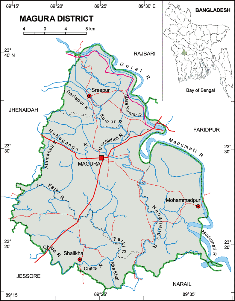
Map of Magura District. Map Courtesy: Banglapedia

Magura District Map Bangladesh

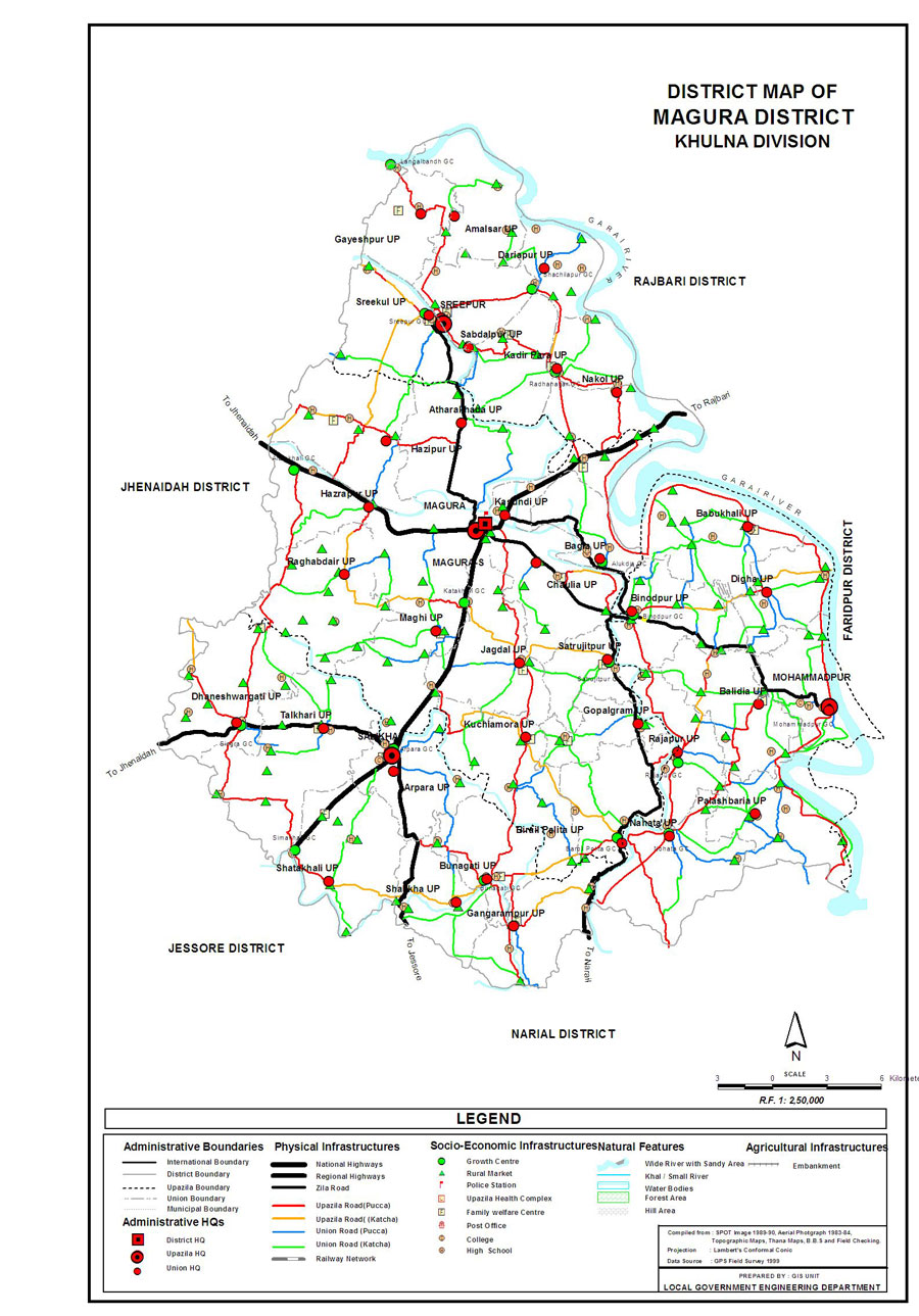
Map of Magura District. Map Courtesy: LGED Bangladesh

Basic Info

Basic Information

Magura District (Khulna division) with an area of 1,048 sq km, is bounded by Rajbari district on the north, Jessore and Narail districts on the south, Faridpur district on the east and Jhenaidah district on the west. Annual average temperature: maximum 37.1 oC, minimum 11.2 oC; annual rainfall 1467 mm. Main rivers are Gorai, Madhumati, Nabaganga and Fatki; Ramsagar and Bural Baor are notable.

At a Glance

Area: 1,048 Km2
Upazila Road: 370.86 Km
Union Road: 431.54 Km
Village Road: 886.45 Km VA
815.85 Km VB
Population: 8,11,160
Density: 774 per Km2
Literacy: 44.7 %
Upazilas: 4
Union: 36
Pourashavas: 1
Primary Schools: 525
High Schools: 110
Colleges: 15

GoogleMap

Reduce


RESOURCES

  • KML file for Magura District: Download
Details
Last Updated: 03 March 2018
© The Bangladesh Network 2014 - 2026
Tourism Directory of BANGLADESH.
  • About
  • Contact
  • License
  • Privacy Policy
  • Terms of Use
Back to top