
Maps
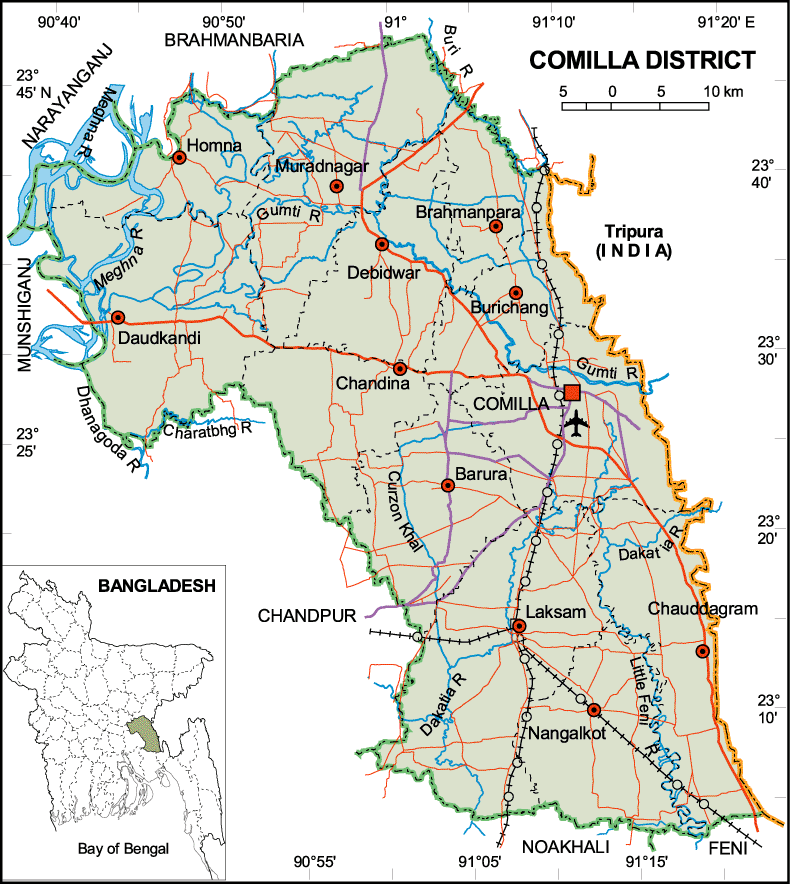
Map of Comilla District. Map Courtesy: Banglapedia
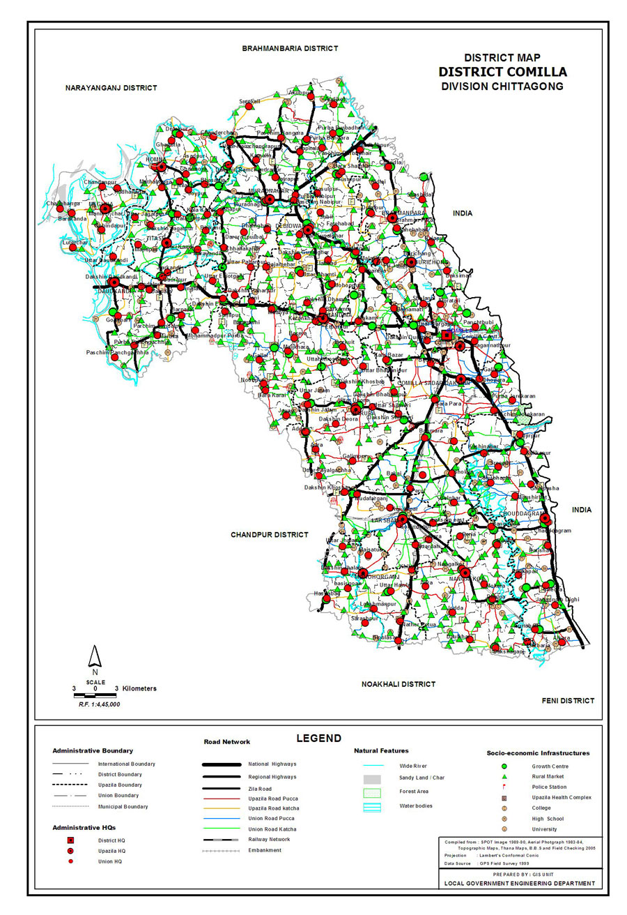
Map of Comilla District. Map Courtesy: LGED Bangladesh
Basic Info
Basic Information |
| Comilla District (Chittagong division) with an area of 3,085.17 sq km, is bounded by brahmanbaria and narayanganj districts on the north, noakhali and feni districts on the south, Tripura (state of India) on the east, munshiganj and chandpur districts on the west. Annual average temperature maximum 34.3 oC, minimum 12.7 oC; annual rainfall 2551 mm. Main rivers are meghna, gumti and dakatia. |
At a Glance |
|
| Area: | 3,085.17 Km2 |
| Upazila Road: | 1115.82 Km |
| Union Road: | 1639.49 Km |
| Village Road: | 3728.64 Km VA |
| 2227.63 Km VB | |
| Population: | 45,91,340 (2001) |
| Density: | 1486.8 per Km2 |
| Literacy: | 60 % |
| Upazilas: | 16 |
| Union: | 179 |
| Pourashavas: | 10 |
| Primary Schools: | |
| High Schools: | |
| Colleges: | |